QUICK READ
The project in three views.
Problem
An emerging occupation can quickly become a consolidated situation with higher safety risks, legal costs and operational constraints.
WORKFLOW
How the components fit together.
Observe
Ingest new satellite scenes.
Detect
Identify occupation and change patterns.
Prioritise
Relate detections to corridors and assets.
Alert
Deliver events for inspection and tracking.
CONTEXT
Detecting change before occupation becomes established
Informal settlements within or near power-transmission corridors create safety, access and fire risks and expose people to critical infrastructure. Once occupation is established, response can involve negotiation, regularisation or relocation with increasing costs.
ANALYSIS
Neural networks to separate meaningful change
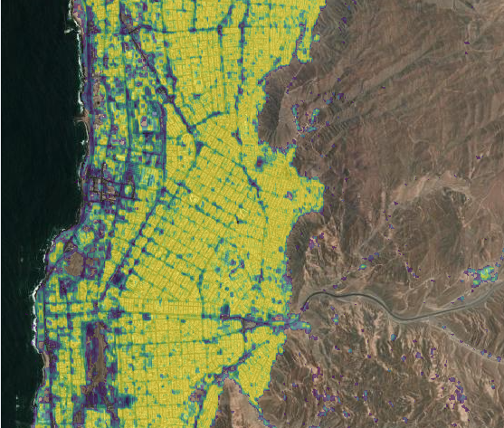
The analytical core used neural-network models trained on satellite imagery to recognise settlements, emerging structures and expansion. Development included data preparation and labelling, training, performance evaluation and spatial criteria designed to reduce false positives from roads, existing infrastructure, bare ground and normal landscape variation.
ANALYSIS
Connecting the model to operational logic
Detections were assessed against safety corridors and electrical assets so that change could be prioritised by location and proximity to critical infrastructure. Each new observation could be compared with previous states to identify appearance, persistence or growth.
ANALYSIS
Turning imagery into a work queue
The platform was designed as a detection, tracking and alert system. The aim was to replace broad manual inspection with spatial evidence showing where to look and when to intervene. The same logic is transferable to easement encroachment, new construction, land-cover loss and other unauthorised activity.
Project figures
See the analysis.
PROJECT VALUE
What this project demonstrates
Ability to train deep-learning models and turn their detections into a recurring territorial-monitoring system connected to critical infrastructure.
In operational monitoring, model performance matters, but value appears when a detection becomes a prioritised and verifiable alert for the team that must act.
Project developed with Grüner SpA. 2024