QUICK READ
The project in three views.
Problem
Road expansion fragments habitat and increases collision risk, while roadkill records alone do not explain where risk may be highest.
WORKFLOW
How the components fit together.
Model
Represent potential habitat.
Overlay
Add road-network exposure.
Compare
Use mortality and sighting observations.
Prioritise
Locate areas for mitigation.
CONTEXT
From potential distribution to risk
Pudú face habitat loss and fragmentation, predation by domestic dogs, competition with exotic species, poaching and vehicle mortality. To examine the road component specifically, the work adapted a traditional habitat model into a spatially explicit risk analysis.
ANALYSIS
Exposure as the link between species and threat
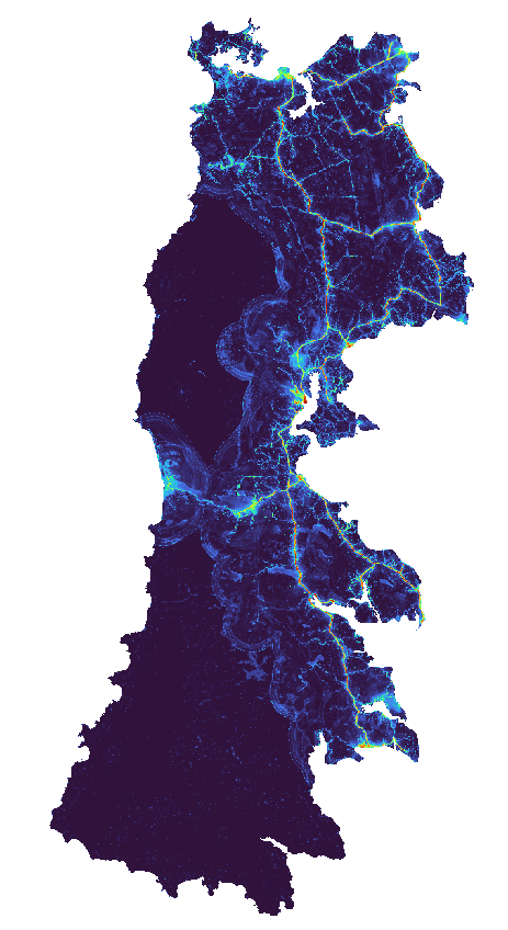
The analysis treated habitat exposure to roads as a critical factor in explaining potential mortality. Combining suitability, the road network and sighting or mortality records helped identify locations where animals are more likely to interact with vehicles.
ANALYSIS
Prioritising where to act
Results were used to identify critical areas and guide preventive measures and mitigation strategies in Chiloé Province. The approach illustrates how an SDM can be extended from an ecological distribution question to a management question about threat, exposure and risk.
Project figures
See the analysis.
PROJECT VALUE
What this project demonstrates
Ability to extend species-distribution modelling into threat and exposure questions, turning ecological results into spatial conservation priorities.
The model shifts the question from “where could the species occur?” to “where does species distribution overlap with a threat capable of causing mortality?”.
Project developed with CECPAN. 2021